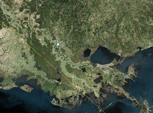
This is a Microsoft Virtual Earth Satellite image of Eastern Louisana overlayed with the National Hurricane Center’s projected path of Gustav [and my sister’s house as the Robin’s Egg in Baton Rouge]. I’m predicting that the New Orleans Levees will hold because the hurricane is passing to the West, so the storm surge on Lake Ponchartrain will go south to north unlike Katrina which passed to the East and sent the Lake’s storm surge directly south at New Orleans. You heard it right here on 1boringoldman.com weather central.
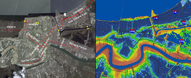
The yellow stars show where Katrina breached the Levees
Sorry, the comment form is closed at this time.